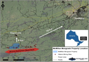
The properties are located within Northeastern Ontario, approximately 13 km south of Espanola and 70 km southwest of Sudbury.
The McMillan Property is comprised of 12 mining leases totaling 268 hectares. The Mongowin Property is comprised of 122 mining and 3 patented claims, totaling 2605 hectares. McFarlane Lake acquired 1 claim by staking April 2022.
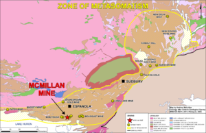
Gold associated with extensive albitization developed along fault systems – linked to timing of 1700 +/- 2 Ma alkalic magmatism.
Multiple high grade gold occurrences focused along E-W trending House Lake and NE trending Fox Lake fault systems. Extensions of McMillan mine mineralization open at depth and along strike.
McMillan is 1 of 3 historical gold producers of >10,000 oz in the region hosted in the Huronian Gold Belt which extends over ~28kms.
1. McMillan Mine ~10koz gold
2. Scadding Mine ~30koz gold
3. Long Lake ~ 55koz gold
McMillan Historical Mining Operation
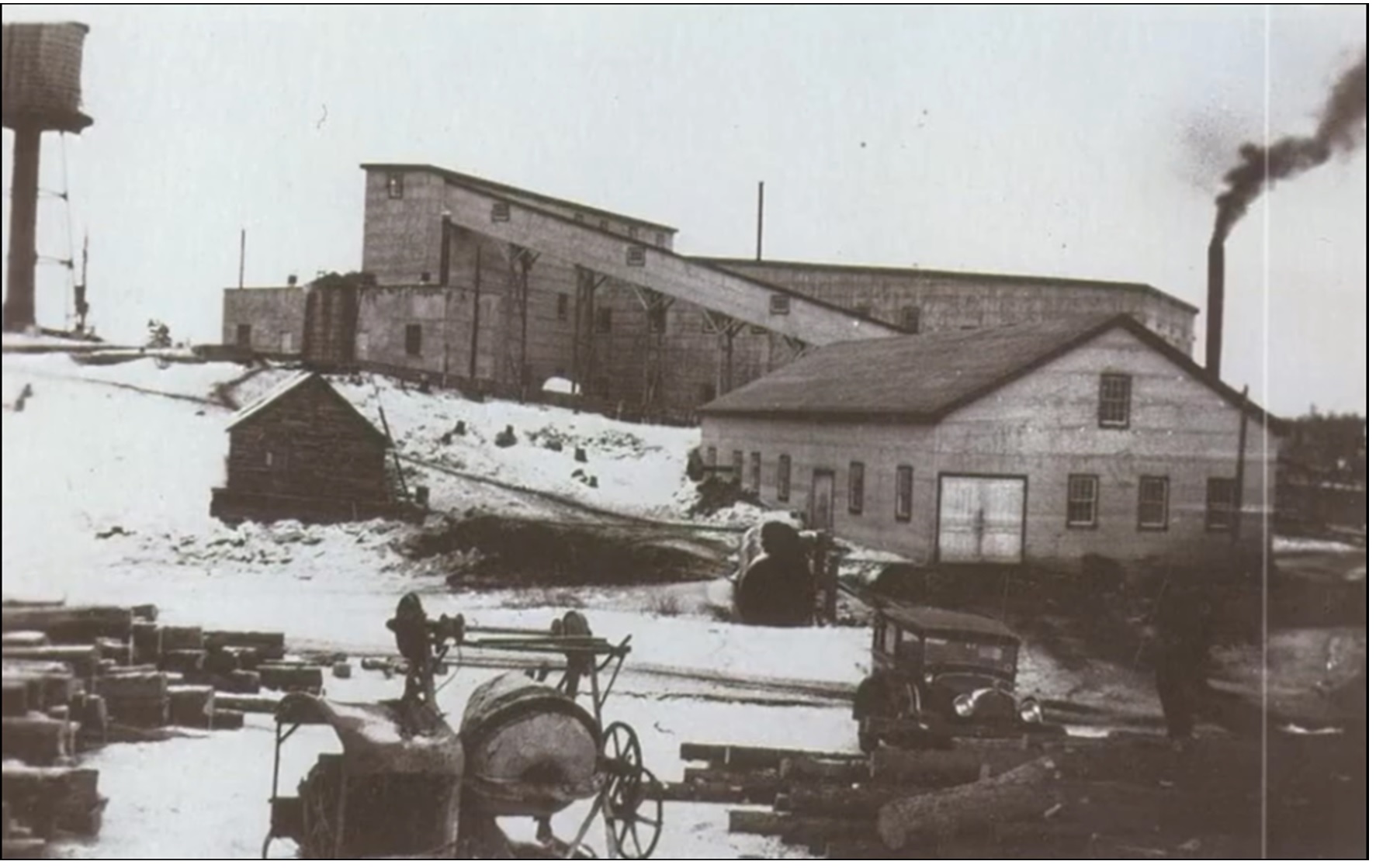
The property was discovered in 1910, initially with test pitting, followed by shaft and level development commencing in 1927.
The shaft reached a depth of 900 feet with development being completed on 7 levels.
Mine production as reported between 1934 and 1937 amounted to approximately 10,591 ounces of gold from 60,139 tons of ore for a recovered grade of 0.176 oz/ton.
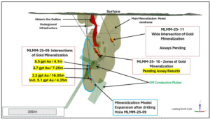
McMillan Mine Significant Gold Intercepts

McMillan Future Work
Focused on drilling the EM Plates within the McMillan Mine structure
Property wide exploration on surface to cover the 9 km trend of the 28 km Huronian gold belt
6 historic workings and multiple gold occurrences, samples of up to 10.9 gpt gold
McMillan is Magnetic! . Excellent tool to discover more mineralization
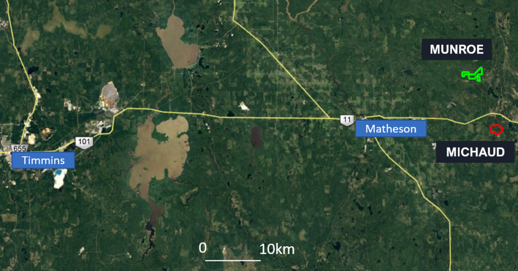
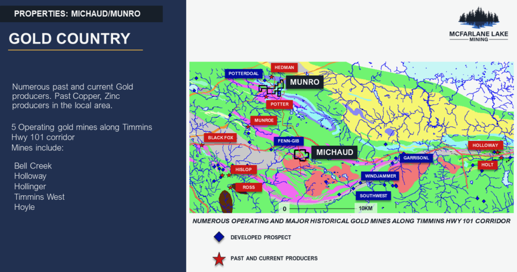
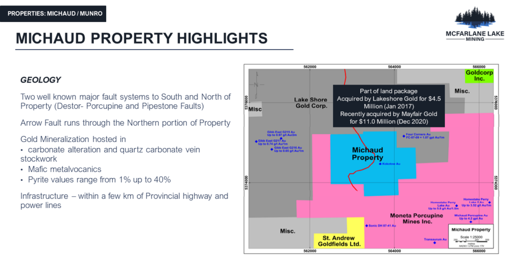
Michaud – Numerous historic shallow gold intersects. Approximately 4000m drilled since 1955, last drilled in 1995. Two well-known major fault systems to South and North of property (Destor-porcupine and pipestone faults). Property was family held for 50+ years until recently
Munro – Munro property is part of the prolific Kidd-Munro Lithostratigraphic assemblage within the Abitibi Greenstone belt. Ultramafic and Mafic Vocanic rocks which hosted 4 VMS producing mines, Kidd Creek mine 80km to the east and Potter, Potterdoal and Hedman mines to the immediate north and south of the property.