Properties
Explore Our Properties
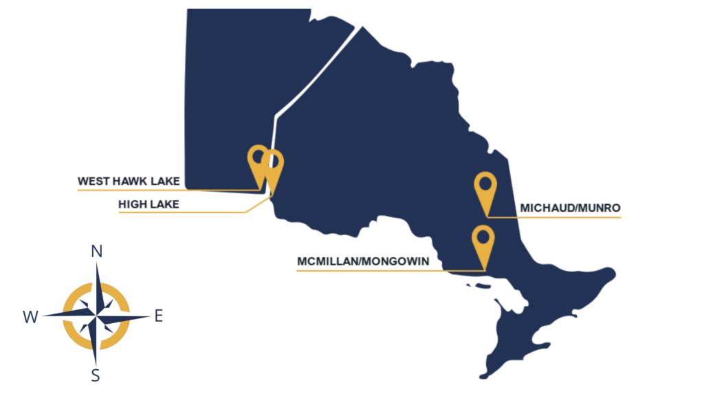
McFarlane has option agreements to acquire 100% of all six properties. Three of the properties are past producers of gold and all 6 properties are near infrastructure (roads, power), significant population bases and in a geo-politically stable environment.
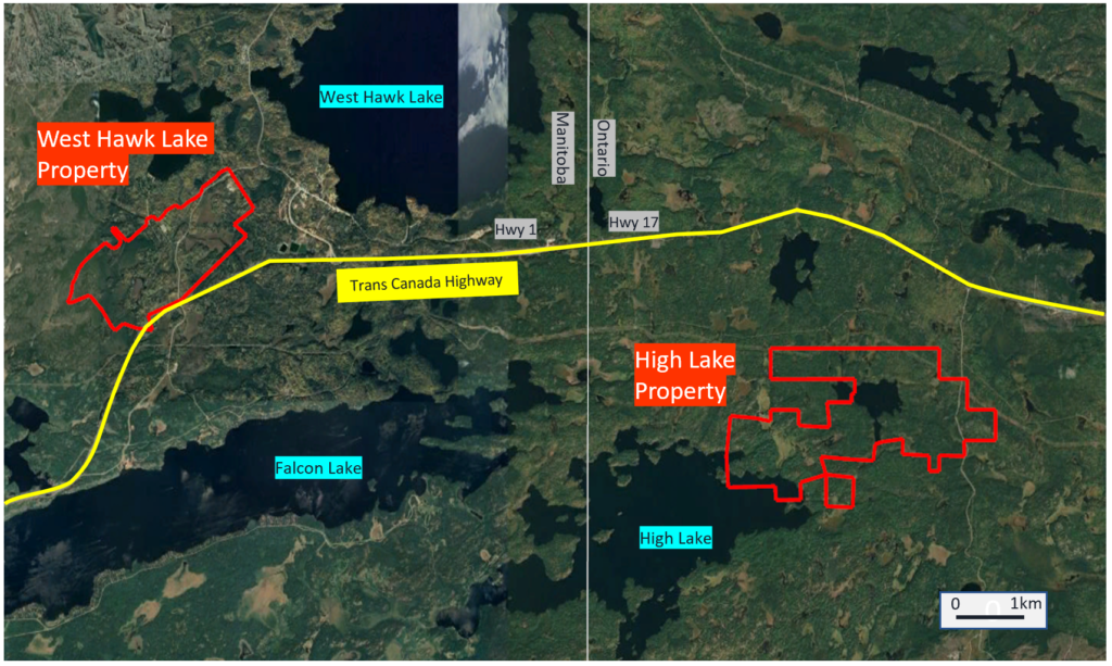
The properties are along the Trans Canada Highway straddling the Manitoba / Ontario border, approximately 35km west of Kenora and 130km east of Winnipeg.
The High Lake and West Hawk Lake properties are in close proximity to each other and could potentially be developed together with multiple mining operations and one processing facility.
The Purdex Zone on the High Lake property has significant exploration potential and will be the primary target for initial exploration and potentially future mining activities.
Click here to view our updated NI 43-101 Technical Report press release
Recent Announcements
- March 6, 2023
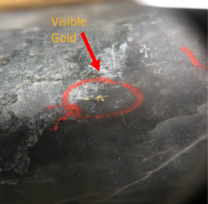
- Gold Intersection of 9.2 g/t gold over 26.4 metres approximately 280 meters from surface (Junior Mining Hub 2nd ranking in intercepts March)
- February 28, 2023
- Within 15 metres of surface, intersected 6.14 g/t gold over 24.55 metres
- February 7, 2023
- Gold Intersection 148.37 g/t gold over 1.3 metres (Junior Mining Hub top 3 weekly Intercepts)
- January 26, 2023
- January 26, 2023
- Gold Intersection of 13.52 g/t gold over 6.5 metres, 229 m from surface
- January 9, 2023
- Gold Intersection of 24.96 grams per tonne of gold over 14.9 metres, 325 m from surface (Junior Mining Hub top 3 weekly intercepts)
- December 12, 2022
- Gold Intersection within 20 meters from surface, 9.82 g/t gold over 9.75 metres
Indicated and Inferred Resource Announced May 23, 2023
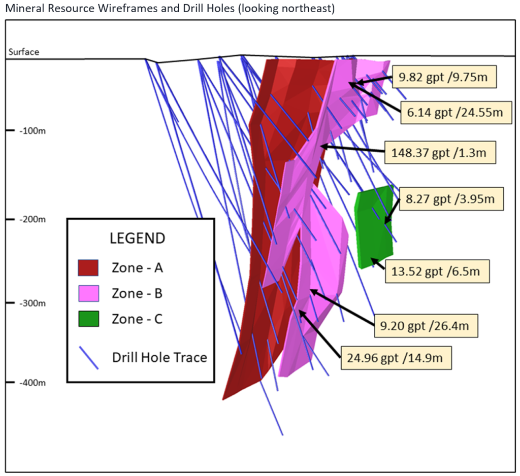
The Mineral Resource Estimate was independently prepared by P&E Mining Consultants Inc in accordance with National Instrument 43-101.
Most of the estimated Mineral Resource tonnage related to the High Lake Deposit is contained in three stacked zones within a 75-metre-wide corridor starting at surface and covering an area of 420 metres vertical by 220 metres long. The true thickness of the High Lake zones varies from 1.2 to 9.0 metres.
The full Technical Report, which is being prepared in accordance with NI-43-101 will be available on SEDAR (www.sedar.com) under the Corporation’s issuer profile within 45 days of the news release.
Classification | Tonnes (k) | Au (g/t) | Au (k Oz) |
Indicated | 152 | 9.38 | 45.8 |
Inferred | 287 | 10.43 | 96.2 |
| Indicated | Inferred | ||||
Au Cut-Off (g/t) | Tonnes (t) | Au Grade (g/t) | Au (Oz) | Tonnes (t) | Au Grade (g/t) | Au (Oz) |
3.0 | 139,747 | 9.95 | 44,705 | 260,540 | 10.98 | 91,975 |
2.8 | 145,051 | 9.69 | 45,189 | 270,031 | 10.7 | 92,894 |
2.6 | 151,851 | 9.38 | 45,794 | 287,373 | 10.43 | 96,165 |
2.4 | 159,140 | 9.06 | 46,355 | 289,847 | 10.15 | 94,586 |
2.2 | 166,374 | 8.77 | 46,911 | 300,930 | 9.86 | 95,397 |
2.0 | 174,316 | 8.47 | 47,469 | 313,324 | 9.55 | 96,203 |
Potential for Open Pit

The mineralized zone on the Purdex Zone extends to surface and there may be an opportunity to mine these Mineral Resources early in a development project through an open pit. P&E has reviewed two potential pit options and subsets of the Mineral Resource that could feasibly be exploited through these options, outlined in the table below.
Potential Pits at 1.0 g.t cut-off (Subsets of Mineral Resource Estimate)
Tonnes (k) | Au Grade (g/t) | Au (k Oz) | ||
Pit 1 | Indicated | 22 | 6.36 | 4.5 |
Inferred | 3 | 5.25 | 0.5 | |
Pit 2 | Indicated | 45 | 4.47 | 6.5 |
Inferred | 7 | 3.65 | 0.8 |
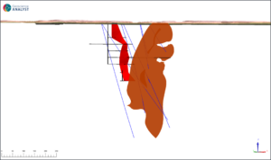
Longitudinal Looking North – AU Grade
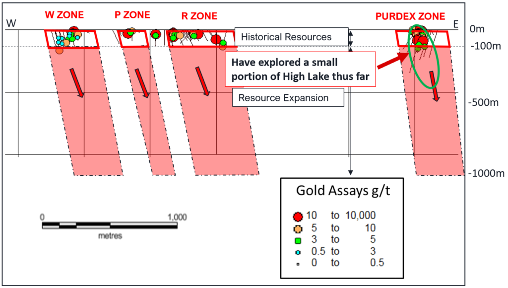
Archean deposits of similar style show long plunge lengths relative to their strike length indicating good depth potential. Additional resources at depth and along strike could be developed with further exploration.
Report References
Leary, G.M., 1989: Report on 1988 Drill Program on the Purdex Property, Kenora Mining Division, Ontario for Consolidated Jalna Resources Limited. 237p.
Reedman, J. H., 1987: Report on Trenching, Sampling and Compilation of Drill Data at High Lake, Northwest, Ontario on behalf of Laramide Services Corporation on Mining Claims held by Calnor Resources, 230p.
Geophysics Data
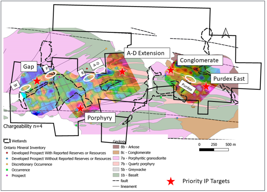
The report identifies five priority targets;
- Purdex East,
- Conglomerate,
- A-D Extension,
- Porphyry and
- Gap.
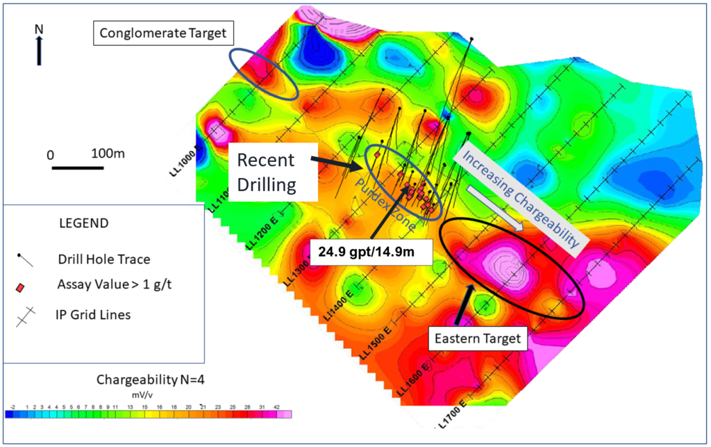
IP surveying shows an increasing chargeability trend east of the Purdex Zone where no drilling has been done, are similar to where we hit high grade gold mineralization.
The geology transitions to a conglomerate Zone to the West of Purdex.
This area remains untested and a possible fold nose may bode well for gold mineralization, we will target these anomalies in our next drill program.
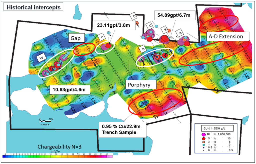
IP surveying has identified three areas on the western grid as priority targets
Gap – untested area between the W and R zone displaying moderate chargeability.
A-D Extension – moderate to high chargeability along extensions of historical zones.
Porphyry – broad moderate to high chargeability within High Lake Porphyry covering a portion of historical trenches.
Gap provides the best opportunity to intersect gold mineralization.
All priority targets warrant drill testing.
New Claims Acquired
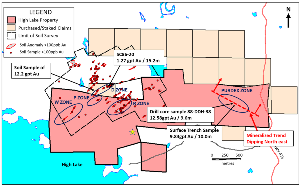
McFarlane acquired fourteen new claims at its High Lake property 7 purchased and 7 staked. The acquisition significantly expands the exploration property at High Lake from 341.49 hectares to 584.43 hectares.
The new claims allow McFarlane to follow the Purdex zone at depth, expand the P zone and explore the previously discovered D Zone.
A soil sampling survey, covering the western portions of the High Lake property and a portion of the newly acquired claims, showed gold values with one result in the D Zone as high as 12.58 gpt gold*.
Limited drilling was completed by Calnor Resources Ltd in 1986 on the Zone D trend with the best results in hole SC86-21 of 1.27 g/t gold over 15.2 metres, including 3.09 g/t gold over 1.5 metres**.
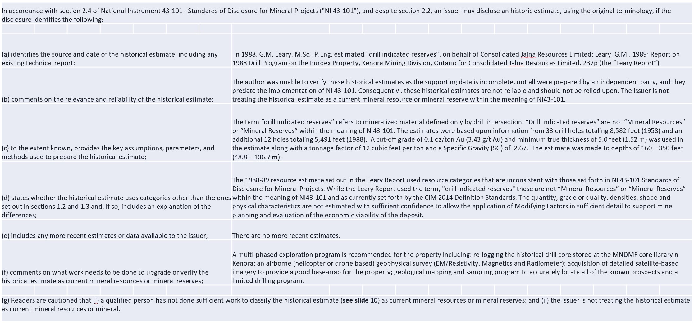
Historical Resources Summary
*Non 43-101 Compliant

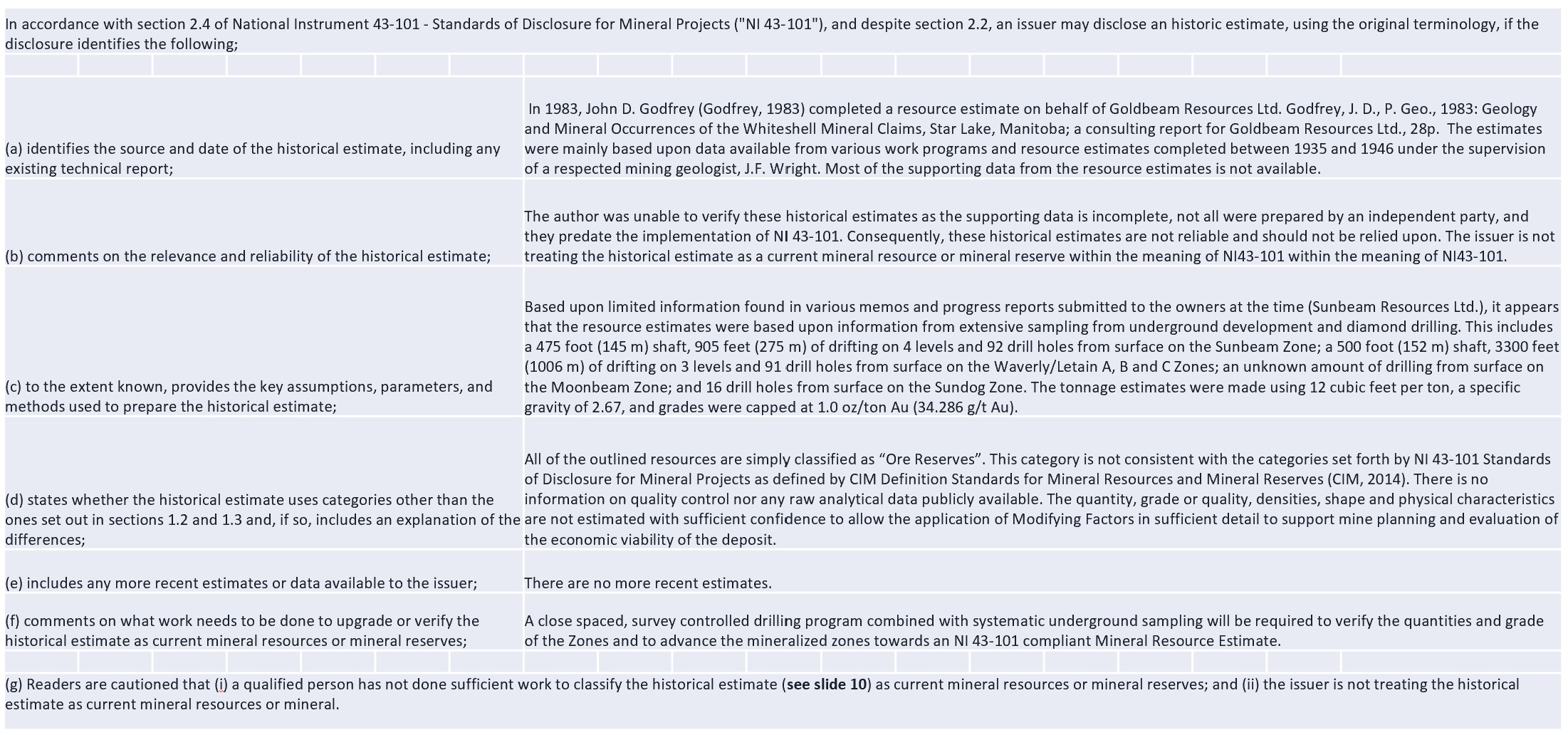
The resource estimates were calculated down to ~100 metres in the early to late 1980’s and used resource categories that are inconsistent with those set forth by NI 43-101 Standards of Disclosure for Mineral Projects.
The 1983 resource estimates were based upon information from extensive sampling from underground development and diamond drilling. All of the outlined resources are simply classified as “Ore Reserves”
The disclosure as required in NI 43-101 section 2.4 is in the following slide MLM states with equal prominence that (i) a qualified person has not done sufficient work to classify the historical estimate as current mineral resources or mineral reserves; and (ii) the issuer is not treating the historical estimate as current mineral resources or mineral.
Historical Resource Disclosure
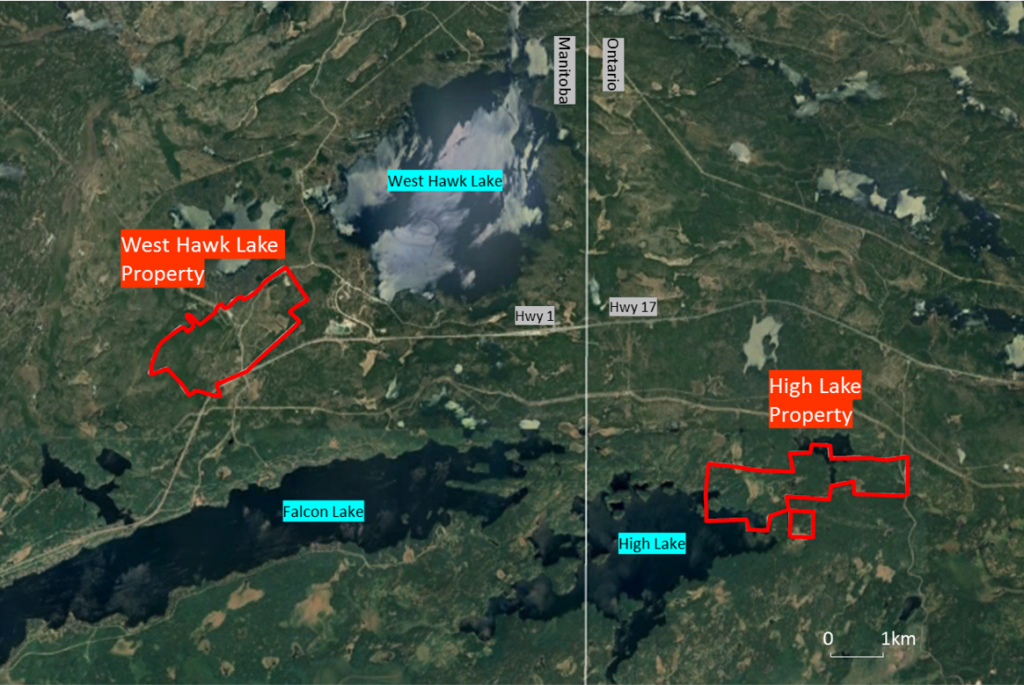
The West Hawk Lake property is comprised of 23 mining claims totalling 336 hectares. It is held under a Manitoba Mining Lease (ML-018).
The property is located within Southeastern Manitoba, approximately 53km west of Kenora and 130km east of Winnipeg.
Note: approximately 10km from High Lake, potential to be developed together.
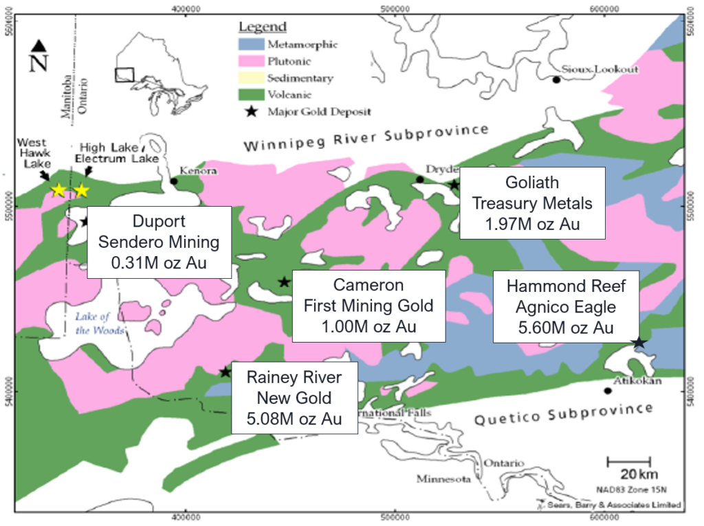
The geological setting on the West Hawk Lake property is consistent with a number of significant gold deposits in Ontario. The property is underlain by metavolcanic/metasediment rocks of Archean Age that have been intrudedby a multi phased intrusive complex grading from quartz monzonite to granodiorite/diorite to gabbro on its outer limits (Falcon Lake Intrusive Complex).
Mineralization is associated with either breccia pipes as at Sunbeam and Moonbeam or as shear zones as at Waverly and Sundog. Excellent exploration potential exists for further discoveries on the West Hawk Lake property.
Click here to View our Technical Report
Historical Resources Summary
*Non 43-101 Compliant

The resource estimates were calculated down to ~100 metres in the early to late 1980’s and used resource categories that are inconsistent with those set forth by NI 43-101 Standards of Disclosure for Mineral Projects.
The 1983 resource estimates were based upon information from extensive sampling from underground development and diamond drilling. All of the outlined resources are simply classified as “Ore Reserves”
The disclosure as required in NI 43-101 section 2.4 is in the following slide MLM states with equal prominence that (i) a qualified person has not done sufficient work to classify the historical estimate as current mineral resources or mineral reserves; and (ii) the issuer is not treating the historical estimate as current mineral resources or mineral.
Historical Resource Exposure
West Hawk Lake

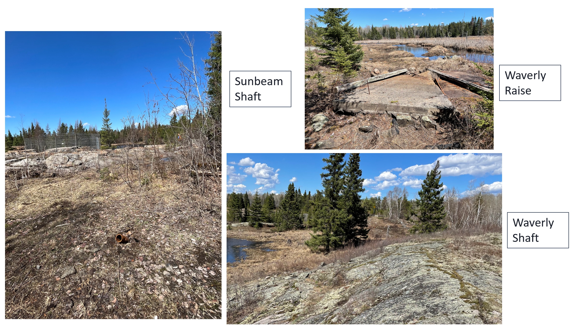
3 shafts located on the property.
Sunbeam inclined shaft to 438 ft with 4 levels established following shallow plunging Sunbeam breccia pipe.
Waverly vertical shaft developed to 500ft with 3 levels established following the Waverly / Letain vein system.
14 shafts are located in the immediate area of the property indicating the potential for future discoveries.
Additional zones are likely to be discovered with additional geophysical surveying, prospecting and diamond drilling.
Historical Mine Workings
Exploration Progress
INITIAL EXPLORATION PROGRAM COMPLETED
Permitting granted October 2021 through Manitoba Parks Department as the property is in a Provincial Park.
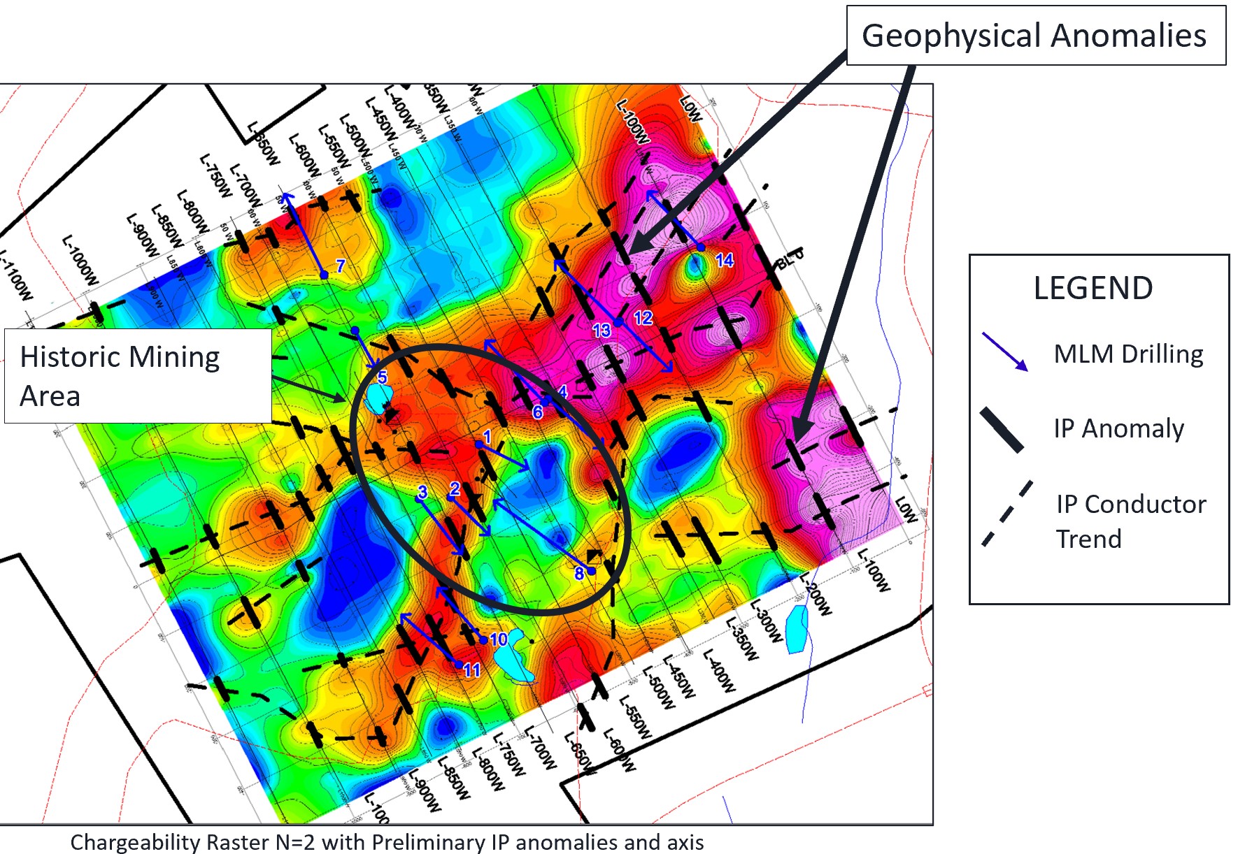
Line cutting completed in December 2021 followed by IP surveying completed in January 2022.
Diamond drilling designed to confirm prior historical results and confirm structural continuity, completed in March 2022.
Follow-up drilling of 10,000m to develop Resources at Waverly Raise and Sunbeam as well as further testing along established favourable trends is warranted.
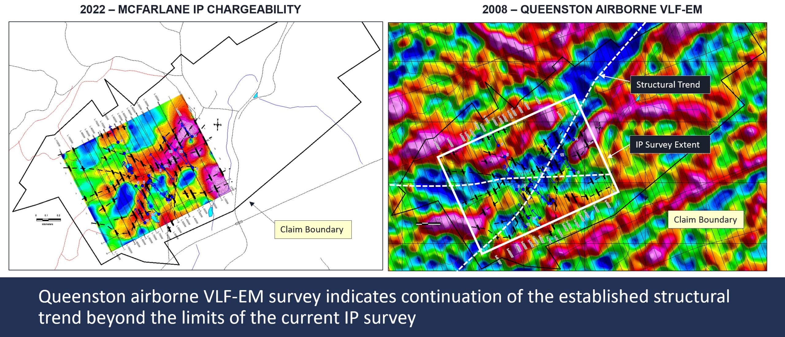
IP and VLF EM Comparison
2022 Drilling Highlights
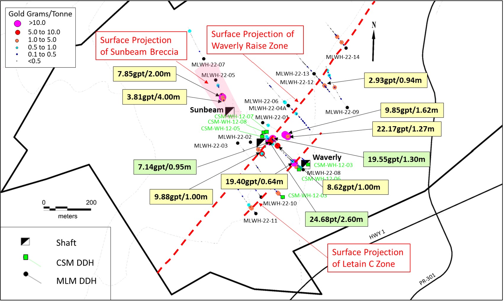
2022 Drilling Highlights of Waverly Raise Zone:
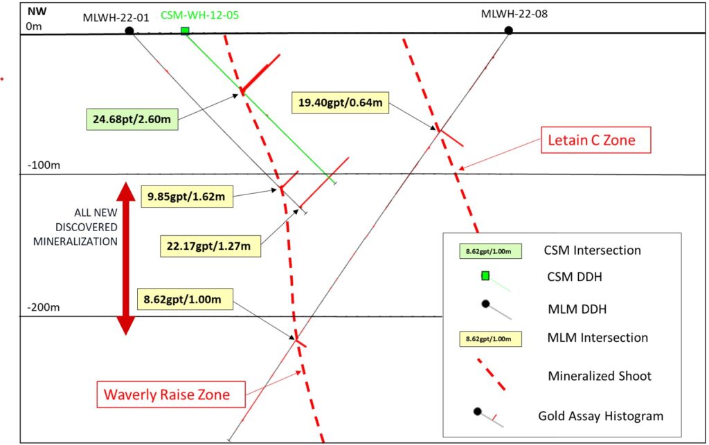
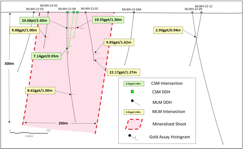
- MLWH-22-01 intersected two zones, 22.17g/t gold over 1.27m including 49.4g/t gold over 0.55m, and 9.85g/t gold over 1.62m.
- MLWH-22-02 intersected a single zone of 9.88g/t over 1.0m.
- MLWH-22-08 intersected two zones, 19.40g/t gold over 0.64m (Letain C) and 8.62g/t gold over 1.0m (Waverly).
- Drilling expanded the strike length of the zone to 200m and down to over 200m, open to depth and discovery of additional shoots along favourable structural and IP trend.
Past Drilling (2012) Highlights in Waverly Raise Zone:
- CSM WH-12-05 intersected 24.68 g/t over 2.6 m.
- CSM WH-12-07 intersected 19.55 g/t over 1.3 m.
2022 Drilling Highlights of Sunbeam Zone:
- MLWH-22-05 intersected two zones, 3.81/g/t gold over 4.0m and 7.85/g/t gold over 2.0m including 11.30g/t gold over 1.0m. Zone remains open for expansion at depth and discovery of additional breccia pipes.
Waverly Raise Zone – Section
Waverly Raise Zone – Longitudinal Section
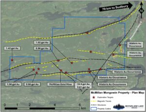
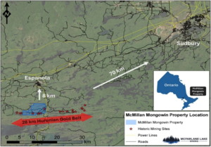 The properties are located within Northeastern Ontario, approximately 13 km south of Espanola and 70 km southwest of Sudbury.
The McMillan Property is comprised of 12 mining leases totaling 268 hectares. The Mongowin Property is comprised of 122 mining and 3 patented claims, totaling 2605 hectares. McFarlane Lake acquired 1 claim by staking April 2022.
Gold associated with extensive albitization developed along fault systems – linked to timing of 1700 +/- 2 Ma alkalic magmatism.
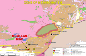
Multiple high grade gold occurrences focused along E-W trending House Lake and NE trending Fox Lake fault systems. Extensions of McMillan mine mineralization open at depth and along strike.
McMillan Historical Mining Operation
- McMillan is 1 of 3 historical gold producers of >10,000 oz in the region
- McMillan Mine ~10 koz gold
- Scadding Mine ~30 koz gold
- Long Lake ~ 55 koz gold
- The largest historical mining operation in the 28 km Huronian Gold Belt trend
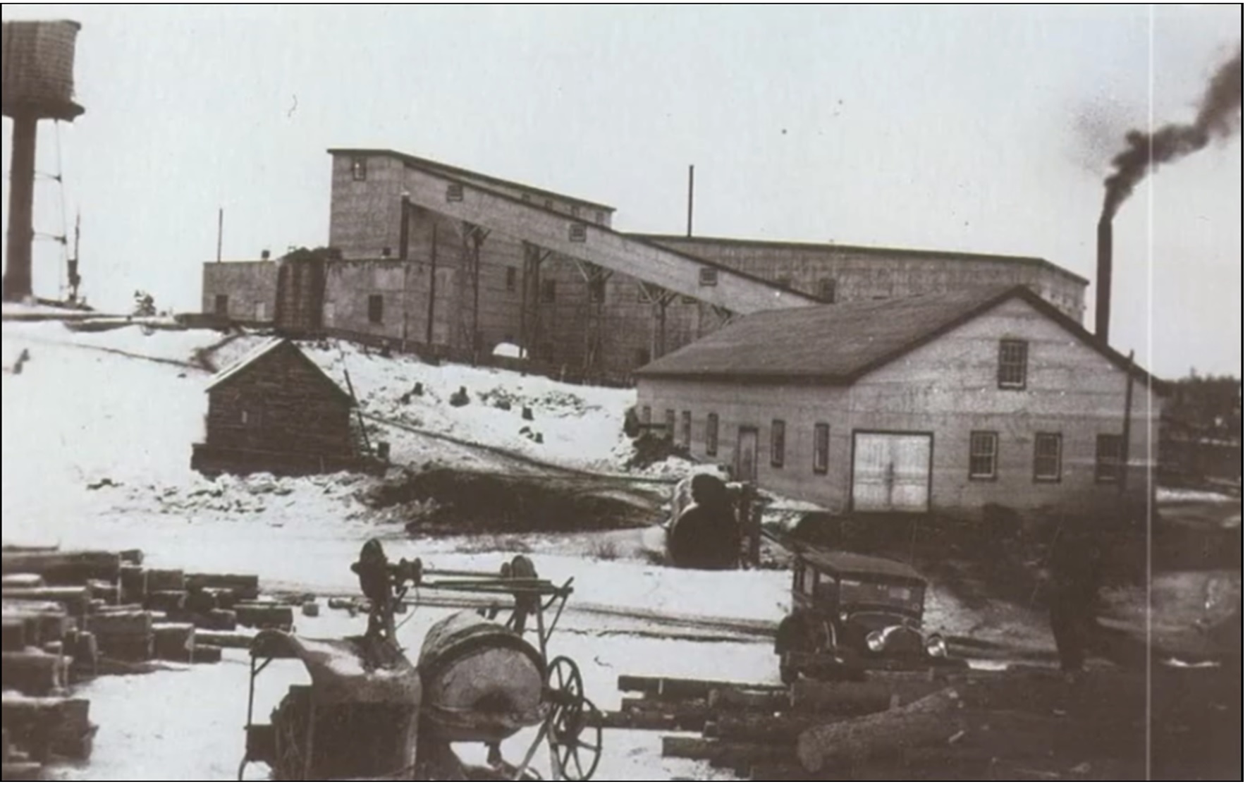
The property has been explored since 1910, initially with test pitting, followed by shaft and level development commencing in 1927. The shaft reached a depth of 900 feet with development being completed on 7 levels.
Mine production as reported between 1934 and 1937 amounted to approximately 10,591 ounces of gold from 60,139 tons of ore for a recovered grade of 0.176 oz/ton.
Geophysics
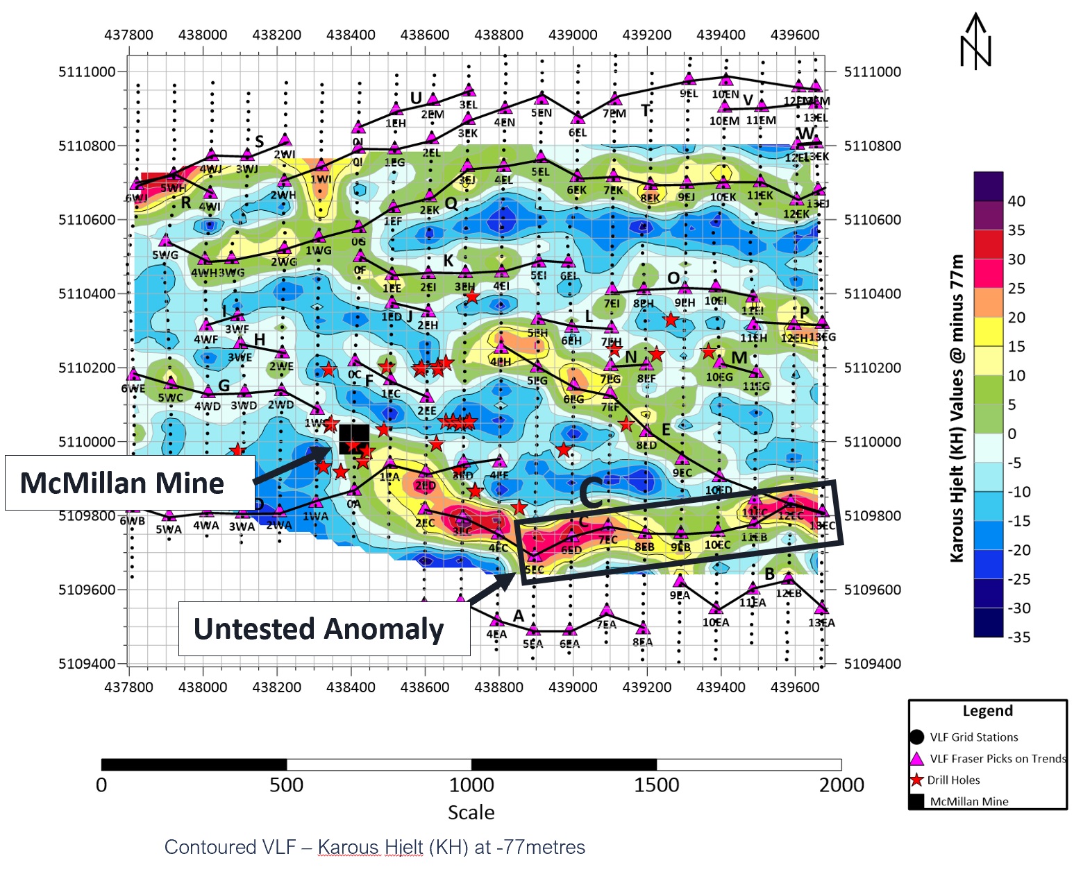
Original VLF survey completed by Ingmar Explorations Limited 1985.
Data was re-processed by Superior Exploration using proprietary software.
A number of high priority targets were identified for ground follow-up and drilling.
Of particular note is anomaly C displaying a continuing of the mine trend to the east beyond current drilling and a strengthening of the anomaly with depth.
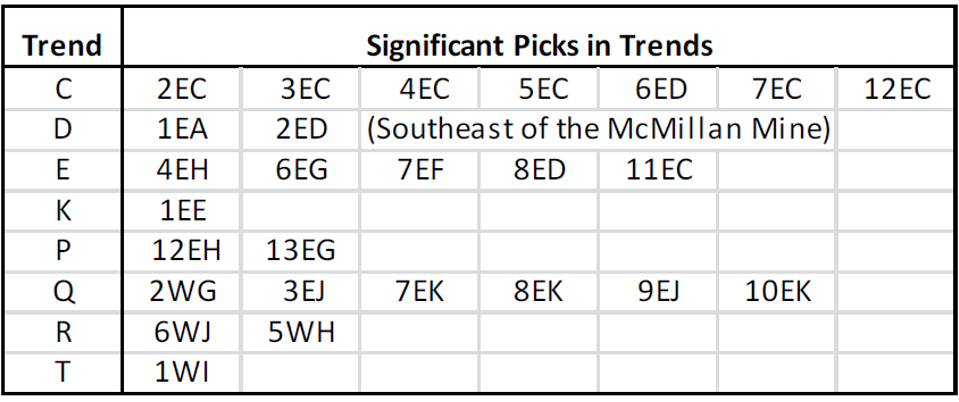
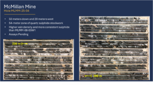
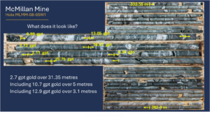
McMillan Mine Significant Gold Intercepts
McMillan Future Work
- Focusing on the McMillan Mine with historic mine infrastructure and year-round access
- Property covers 9 km of the 28 km Huronian gold belt
- 6 historic workings and multiple gold occurrences, samples of up to 10.9 gpt gold
- McMillan is Magnetic! Magnetic anomalies may represent more mineralization. Excellent tool to discover more mineralization
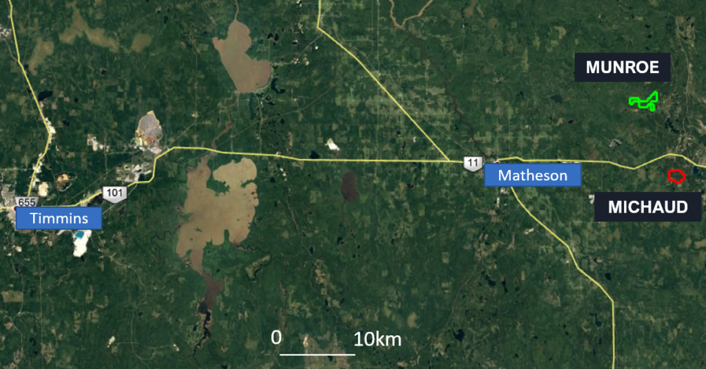
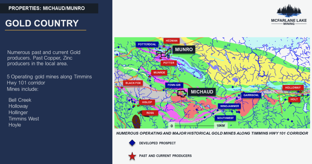
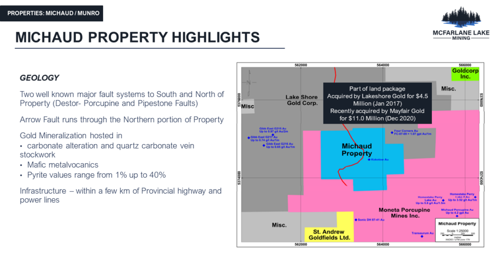
Michaud – Numerous historic shallow gold intersects. Approximately 4000m drilled since 1955, last drilled in 1995. Two well-known major fault systems to South and North of property (Destor-porcupine and pipestone faults). Property was family held for 50+ years until recently
Munro – Munro property is part of the prolific Kidd-Munro Lithostratigraphic assemblage within the Abitibi Greenstone belt. Ultramafic and Mafic Vocanic rocks which hosted 4 VMS producing mines, Kidd Creek mine 80km to the east and Potter, Potterdoal and Hedman mines to the immediate north and south of the property.
